Category:Old Clee
Jump to navigation
Jump to search
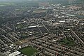
English: Old Clee is located in the Clee Road ( A46) and Carr Lane area of eastern Grimsby, North East Lincolnshire, England and adjoins the neighbouring town of Cleethorpes, with which it has historic links. Previously a separate village, its parish church of Holy Trinity and Saint Mary, claimed to be the oldest building in Grimsby, has a Saxon tower dating from 1050 AD. Located in the area are the Old Clee infants/junior schools (Colin Avenue) and the Havelock Specialist Engineering College (Holyoake Road). Nearby is the King George V Stadium.
a village located in United Kingdom  | |||||
| Upload media | |||||
| Instance of | |||||
|---|---|---|---|---|---|
| Location | North East Lincolnshire, Lincolnshire, Yorkshire and the Humber, England | ||||
 | |||||
Subcategories
This category has the following 4 subcategories, out of 4 total.
B
- Blundell Park (10 F)
S
- St Aidan's church, Grimsby (3 F)
T
- Holy Trinity, Old Clee (5 F)
W
- Weelsby Road, Grimsby (12 F)
Media in category "Old Clee"
The following 100 files are in this category, out of 100 total.
-
 60 and 62 Clee Crescent - geograph.org.uk - 4969000.jpg 1,024 × 768; 238 KB
-
 Access to Weelsby Woods - geograph.org.uk - 599625.jpg 640 × 480; 79 KB
-

-
 Beaconthorpe Methodist Church - geograph.org.uk - 280110.jpg 640 × 545; 83 KB
-
 Carr Lane - geograph.org.uk - 3475984.jpg 640 × 480; 63 KB
-
 Carr Lane, Old Clee - geograph.org.uk - 3475987.jpg 640 × 480; 65 KB
-
 Chester Place, Cleethorpes - geograph.org.uk - 4155037.jpg 1,600 × 1,064; 537 KB
-
 Clee Hall.jpg 1,024 × 753; 657 KB
-
 Clee Village - geograph.org.uk - 3198356.jpg 640 × 427; 74 KB
-
 Clee Village - geograph.org.uk - 3198370.jpg 640 × 427; 117 KB
-
 Clee Village - geograph.org.uk - 3198395.jpg 640 × 427; 60 KB
-
 Cleethorpes 2007 (aerial), 2 - geograph.org.uk - 3149164.jpg 640 × 480; 131 KB
-
 Cleethorpes 2007 (aerial), 3 - geograph.org.uk - 3149156.jpg 640 × 480; 139 KB
-
 Cleethorpes 2007 (aerial), 4 - geograph.org.uk - 3149148.jpg 640 × 480; 91 KB
-
 Cleethorpes Circus in Town - geograph.org.uk - 2615114.jpg 640 × 480; 87 KB
-

-
 Cleethorpes Water Tower - geograph.org.uk - 280781.jpg 473 × 640; 96 KB
-
 Corpus Christi Church - geograph.org.uk - 280100.jpg 640 × 469; 97 KB
-
 Cottage in Old Clee - geograph.org.uk - 3196539.jpg 640 × 427; 64 KB
-
 Cottage in Old Clee - seen from the churchyard - geograph.org.uk - 4224053.jpg 3,487 × 2,736; 1.96 MB
-
 Council estate off Clee Road - geograph.org.uk - 3176401.jpg 640 × 427; 99 KB
-
 Cut Mark, Cleethorpes Cemetery Chapel - geograph.org.uk - 3494216.jpg 640 × 478; 111 KB
-

-
 Davenport Drive junction with Humberston Road - geograph.org.uk - 3216475.jpg 1,024 × 768; 181 KB
-
 Former school, now Village Hall - geograph.org.uk - 4969929.jpg 1,024 × 768; 161 KB
-
 Frobisher Avenue, Old Clee, Grimsby - geograph.org.uk - 2030512.jpg 800 × 600; 237 KB
-
 Grimsby, aerial 2016 - geograph.org.uk - 4914405.jpg 640 × 427; 106 KB
-
 Havelock Academy - geograph.org.uk - 5073622.jpg 1,024 × 768; 180 KB
-
 Heron Close off Weelsby Road - geograph.org.uk - 4154925.jpg 1,600 × 1,064; 480 KB
-
 Heron Close off Weelsby Road - geograph.org.uk - 4155006.jpg 1,600 × 1,064; 527 KB
-
 Houses at Lovelane Corner, Weelsby - geograph.org.uk - 4155025.jpg 1,600 × 1,064; 761 KB
-
 Houses at Villa Court, Humberston Road - geograph.org.uk - 4155112.jpg 1,600 × 1,064; 466 KB
-
 Houses on Ashridge Drive, Cleethorpes - geograph.org.uk - 4155096.jpg 1,600 × 1,064; 582 KB
-
 Houses on Carr Lane - geograph.org.uk - 3475982.jpg 640 × 480; 70 KB
-
 Houses on Heron Close off Weelsby Road - geograph.org.uk - 4155013.jpg 1,600 × 1,064; 566 KB
-
 Houses on Weelsby Road - At Love Lane Corner - geograph.org.uk - 4224047.jpg 3,422 × 2,407; 1.52 MB
-
 Houses on Windsor Road, Cleethorpes - geograph.org.uk - 4155041.jpg 1,600 × 1,064; 452 KB
-
 Houses on Windsor Road, Cleethorpes - geograph.org.uk - 4155045.jpg 1,600 × 1,064; 458 KB
-
 Humberston Avenue towards Lovelane Corner - geograph.org.uk - 4155122.jpg 1,600 × 1,064; 835 KB
-
 Humberston Road (A1031) - geograph.org.uk - 3475995.jpg 640 × 480; 99 KB
-
 Isaac's Hill, Cleethorpes - geograph.org.uk - 2744801.jpg 640 × 444; 39 KB
-
 King George V Stadium, Weelsby road - geograph.org.uk - 741915.jpg 640 × 428; 41 KB
-
 Large House on Vaughan Avenue - geograph.org.uk - 3475989.jpg 640 × 480; 64 KB
-
 Matthew Humberstone School - geograph.org.uk - 2046741.jpg 800 × 600; 238 KB
-
 Mister Angelo's Ice Cream Van - geograph.org.uk - 4155108.jpg 1,588 × 1,600; 960 KB
-
 Moat at Old Clee - geograph.org.uk - 4969893.jpg 1,024 × 768; 284 KB
-
 Old Clee (geograph 5143638).jpg 640 × 427; 60 KB
-
 Old Clee - geograph.org.uk - 85773.jpg 640 × 427; 61 KB
-
 Old Clee, Grimsby - geograph.org.uk - 2084786.jpg 1,024 × 764; 357 KB
-
 Old Clee, Grimsby - geograph.org.uk - 2085096.jpg 1,024 × 768; 398 KB
-
 Old Clee, Grimsby - geograph.org.uk - 2085109.jpg 1,024 × 744; 554 KB
-
 Old Clee, Grimsby - geograph.org.uk - 2085117.jpg 1,024 × 768; 658 KB
-
 Old Clee, Grimsby - geograph.org.uk - 2085139.jpg 3,072 × 2,304; 3.38 MB
-
 Old Clee, Grimsby - geograph.org.uk - 2085166.jpg 3,027 × 2,241; 4.84 MB
-
 Old Clee, Grimsby - geograph.org.uk - 2085184.jpg 3,072 × 2,304; 2.99 MB
-
 Old Clee, village hall, no.1 - geograph.org.uk - 3198272.jpg 640 × 427; 95 KB
-
 Old house on the edge of Old Clee - geograph.org.uk - 4224051.jpg 2,736 × 3,648; 2.3 MB
-
 Open fields in Old Clee - geograph.org.uk - 3196529.jpg 640 × 427; 106 KB
-
 Open fields in Old Clee - geograph.org.uk - 3198289.jpg 640 × 427; 97 KB
-
 Open fields in Old Clee - geograph.org.uk - 3198317.jpg 640 × 427; 88 KB
-
 Path leading to Humberstone Road, Grimsby - geograph.org.uk - 4155128.jpg 1,600 × 1,064; 512 KB
-
 Pavilion on Recreation ground - geograph.org.uk - 1957879.jpg 640 × 480; 68 KB
-
 Pavilion on Recreation Ground - geograph.org.uk - 4856567.jpg 2,000 × 1,333; 1.29 MB
-

-

-
 Psychic Garden - geograph.org.uk - 4856546.jpg 2,000 × 1,333; 1.39 MB
-
 Roundabout at bottom of Isaac's Hill - geograph.org.uk - 4574437.jpg 640 × 279; 97 KB
-
 Roundabout on Davenport Drive - geograph.org.uk - 3216465.jpg 1,024 × 768; 116 KB
-
 Rubbish collection on Clee Road - geograph.org.uk - 4574426.jpg 640 × 438; 177 KB
-
 Sandringham Road, Cleethorpes - geograph.org.uk - 4015101.jpg 640 × 427; 70 KB
-
 Semi-detached cottages in Old Clee - geograph.org.uk - 3196548.jpg 640 × 427; 101 KB
-
 Single Line - geograph.org.uk - 373638.jpg 640 × 425; 58 KB
-
 St Andrew's College - geograph.org.uk - 3475993.jpg 640 × 480; 120 KB
-
 St Helier's Road, Cleethorpes - geograph.org.uk - 2744809.jpg 800 × 532; 85 KB
-
 St Hugh's Avenue, Cleethorpes - geograph.org.uk - 4224057.jpg 2,606 × 3,121; 2.08 MB
-
 St Mary's Close, Old Clee, Grimsby - geograph.org.uk - 2030521.jpg 800 × 600; 232 KB
-
 Suggits Lane - geograph.org.uk - 373648.jpg 640 × 424; 73 KB
-
 The A46 Weelsby Road - geograph.org.uk - 4155021.jpg 1,600 × 1,064; 627 KB
-
 The Crows Nest Hotel on Balmoral Road - geograph.org.uk - 4155057.jpg 1,600 × 1,064; 474 KB
-
 The Crows Nest Hotel on Balmoral Road - geograph.org.uk - 4155063.jpg 1,600 × 1,064; 545 KB
-
 The Crows Nest Hotel on Balmoral Road - geograph.org.uk - 4155086.jpg 1,202 × 1,600; 444 KB
-
 The Crows Nest Hotel on Balmoral Road - geograph.org.uk - 4155090.jpg 1,177 × 1,600; 416 KB
-
 The former Matthew Humberstone School - geograph.org.uk - 4969904.jpg 1,024 × 768; 162 KB
-
 The path from the church, Old Clee - geograph.org.uk - 4969944.jpg 1,024 × 768; 334 KB
-
 The Spiders Web pub in Old Clee, Grimsby - geograph.org.uk - 2030771.jpg 800 × 600; 297 KB
-
 The Spiders Web pub, Old Clee - geograph.org.uk - 3475985.jpg 640 × 480; 62 KB
-

-
 Vivian Avenue - geograph.org.uk - 3475991.jpg 640 × 480; 78 KB
-
 Vivian Avenue, Weelsby - geograph.org.uk - 4224045.jpg 3,455 × 2,633; 1.68 MB
-
 Windsor Road, Grimsby - geograph.org.uk - 2046789.jpg 800 × 600; 212 KB
-
 York Place off Windsor Road, Cleethorpes - geograph.org.uk - 4155050.jpg 1,600 × 1,064; 690 KB
-
 Young's Seafood Factory on Humberstone Road - geograph.org.uk - 4155193.jpg 1,600 × 1,064; 411 KB
-
 Belvoir Road - geograph.org.uk - 305652.jpg 640 × 480; 99 KB
-
 Blundell Park - geograph.org.uk - 281352.jpg 640 × 482; 98 KB
-
 Electricity Board Showroom - geograph.org.uk - 280512.jpg 640 × 538; 98 KB
-
 Entrance to Weelsby Woods - geograph.org.uk - 529354.jpg 640 × 419; 54 KB
-
 Fiveways roundabout - geograph.org.uk - 737471.jpg 640 × 428; 43 KB
-
 Storm view - geograph.org.uk - 373047.jpg 640 × 480; 76 KB
-
 The Imperial - geograph.org.uk - 281336.jpg 640 × 440; 92 KB
-
 The Pear Tree Public House - geograph.org.uk - 305052.jpg 624 × 467; 107 KB


,_2_-_geograph.org.uk_-_3149164.jpg)
,_3_-_geograph.org.uk_-_3149156.jpg)
,_4_-_geograph.org.uk_-_3149148.jpg)


_-_geograph.org.uk_-_3475995.jpg)


.jpg)


